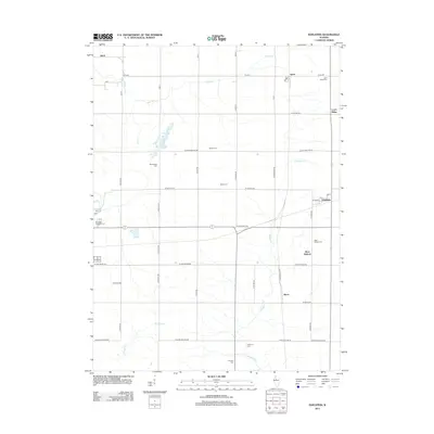
2012 Map of Edelstein
USGS Topo · Published 2012About this map
Edelstein and its surrounding rural townships are characterized by a dense network of family-named cemeteries and small agricultural settlements. The landscape is defined by the branching waterways of Kickapoo Cr, Mud Run, and Hickory Run, which cut through the square-grid road system of northern Peoria County. Genealogists will find significant value in the distribution of burial grounds across the territory, including the Apostolic Christian Cem to the west and the West Hallock Cem near the community of West Hallock. The presence of the Po at Speer and the cluster of streets in Edelstein, such as W Main St and 3rd St, indicate the enduring centers of local commerce and community. Other small hubs like Akron, Stark, and Lawn Ridge further illustrate the early 21st-century settlement pattern of this Illinois prairie region.
Find a feature on this map
49 named features on this map. Tap any name to fly to it.
Don’t see what you’re looking for? This feature index may not catch every label — zoom into the map to look around manually.
Map Details
Editions of this 2012 Edelstein Map
This is the sole edition of this map. No revisions or reprints were ever made.
Other maps of this area

1893 · Dunlap
USGS Topo · 1:62,500

1898 · Dunlap
USGS Topo · 1:62,500

1932 · Dunlap
USGS Topo · 1:62,500

1933 · Dunlap
USGS Topo · 1:62,500

1933 · Camp Grove
USGS Topo · 1:48,000

1937 · Dunlap
USGS Topo · 1:62,500

1944 · Kewanee
USGS Topo · 1:62,500

1944 · Elmwood
USGS Topo · 1:62,500

1945 · Bradford
USGS Topo · 1:62,500

1948 · Elmwood
USGS Topo · 1:62,500