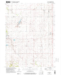
1998 Map of Edelstein
USGS Topo · Published 2001About this map
Princeville and Edelstein anchor this Illinois landscape where the agricultural prairies of La Prairie and Akron townships meet the industrial excavations of several Gravel Pits. The map reveals a transition from rail-era infrastructure to modern recreational use, most notably along the Old Rock Island State Trail, which traces the former railroad corridor northwest through Valley. For local historians and genealogists, the density of rural burial sites is significant, including Lawn Ridge Cem, Streitmatter Cem, and Hitchcock Cem. Water patterns are defined by the winding course of Kickapoo Creek and Mud Run, while smaller settlements like West Hallock and Speer remain connected by the historic Stark Trail. The presence of a Landing Strip and municipal Sewage Disposal Ponds reflects the late-century infrastructure of these central Illinois communities.
Find a feature on this map
33 named features on this map. Tap any name to fly to it.
Don’t see what you’re looking for? This feature index may not catch every label — zoom into the map to look around manually.
Map Details
Editions of this 1998 Edelstein Map
This is the sole edition of this map. No revisions or reprints were ever made.
Other maps of this area

1893 · Dunlap
USGS Topo · 1:62,500

1898 · Dunlap
USGS Topo · 1:62,500

1932 · Dunlap
USGS Topo · 1:62,500

1933 · Dunlap
USGS Topo · 1:62,500

1933 · Camp Grove
USGS Topo · 1:48,000

1937 · Dunlap
USGS Topo · 1:62,500

1944 · Kewanee
USGS Topo · 1:62,500

1944 · Elmwood
USGS Topo · 1:62,500

1945 · Bradford
USGS Topo · 1:62,500

1948 · Elmwood
USGS Topo · 1:62,500