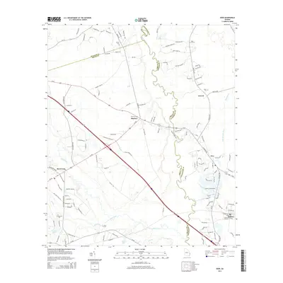
2014 Map of Eden
USGS Topo · Published 2014About this map
The Ogeechee River snakes through the heart of this coastal plain landscape, defining the winding boundary between Bulloch, Bryan, and Effingham counties. In this 2014 edition, the settlement pattern shows a concentration of local history around the highway intersections and river crossings, particularly at Blitchton, where Blitch Cem stands near the junction of GA-26 and US-280. Further east, the community of Eden and the town of Meldrim mark the transition toward the suburban reaches of the region, while smaller locales like Doswell remain tucked away near Ogeechee Run. Genealogists will find a high density of family and community burial sites, including Eldora Cem, Sand Hill Cem, and Bird Cem. The presence of the Cypress Lakes Airport and the complex network of creeks like Black Creek and Mill Creek illustrate the diverse land use of this Georgia corridor.
Find a feature on this map
131 named features on this map. Tap any name to fly to it.
Don’t see what you’re looking for? This feature index may not catch every label — zoom into the map to look around manually.
Map Details
Editions of this 2014 Eden Map
This is the sole edition of this map. No revisions or reprints were ever made.
Other maps of this area

1919 · Egypt
USGS Topo · 1:62,500

1920 · Pembroke
USGS Topo · 1:62,500

1920 · Meldrim
USGS Topo · 1:62,500

1921 · Brooklet
USGS Topo · 1:62,500

1939 · Egypt
USGS Topo · 1:62,500

1942 · Meldrim
USGS Topo · 1:62,500

1943 · Brooklet
USGS Topo · 1:62,500

1943 · Egypt
USGS Topo · 1:62,500

1947 · Savannah
USGS Topo · 1:250,000

1948 · Savannah
USGS Topo · 1:250,000