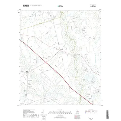
2020 Map of Eden
USGS Topo · Published 2020About this map
The Ogeechee River snakes along the boundary of Bryan, Bulloch, and Effingham Counties, defining a landscape of low-lying wetlands and established rural settlements. This 2020 survey captures the modern road network intersecting with long-standing community landmarks, such as the Black Creek Church and several family-named burial grounds. The settlement of Blitchton sits at a primary junction, while to the southeast, the towns of Eden and Meldrim maintain their distinct identities near the river's edge.
Find a feature on this map
121 named features on this map. Tap any name to fly to it.
Don’t see what you’re looking for? This feature index may not catch every label — zoom into the map to look around manually.
Map Details
Editions of this 2020 Eden Map
This is the sole edition of this map. No revisions or reprints were ever made.
Other maps of this area

1919 · Egypt
USGS Topo · 1:62,500

1920 · Pembroke
USGS Topo · 1:62,500

1920 · Meldrim
USGS Topo · 1:62,500

1921 · Brooklet
USGS Topo · 1:62,500

1939 · Egypt
USGS Topo · 1:62,500

1942 · Meldrim
USGS Topo · 1:62,500

1943 · Brooklet
USGS Topo · 1:62,500

1943 · Egypt
USGS Topo · 1:62,500

1947 · Savannah
USGS Topo · 1:250,000

1948 · Savannah
USGS Topo · 1:250,000