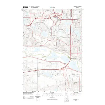
2013 Map of Eden Prairie
USGS Topo · Published 2013About this map
Flying Cloud Airport and the surrounding suburban development of Hennepin County anchor this 2013 landscape, where the Minnesota River serves as a natural boundary with Scott County. The area is characterized by a dense concentration of lakes, including Staring Lake, Bush Lake, and Anderson Lakes, alongside the significant industrial and recreational sites that have shaped the region's modern growth. Large-scale attractions like Valleyfair Amusement Park and Canterbury Park sit just south of the river, while historic preservation is evident at Murphy's Landing. Local history and genealogy are supported by the presence of several established burial grounds, such as Eden Prairie Cemetery and Glendale Cemetery. The transport network shows a high-density grid of modern roads like Valley View Road and MN-5 intersecting older settlement points such as Rowland and Glendale, illustrating the rapid evolution of the Twin Cities' southwestern suburbs.
Find a feature on this map
168 named features on this map. Tap any name to fly to it.
Don’t see what you’re looking for? This feature index may not catch every label — zoom into the map to look around manually.
Map Details
Editions of this 2013 Eden Prairie Map
This is the sole edition of this map. No revisions or reprints were ever made.
Other maps of this area

1896 · Minneapolis
USGS Topo · 1:62,500

1901 · Minneapolis
USGS Topo · 1:62,500

1905 · Minnetonka
USGS Topo · 1:62,500

1907 · Minnetonka
USGS Topo · 1:62,500

1952 · Minneapolis South
USGS Topo · 1:24,000

1953 · Saint Paul
USGS Topo · 1:250,000

1954 · Hopkins
USGS Topo · 1:24,000

1954 · Bloomington
USGS Topo · 1:24,000

1954 · Eden Prairie
USGS Topo · 1:24,000

1954 · Minneapolis
USGS Topo · 1:62,500