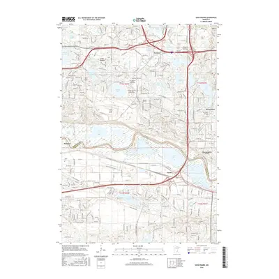
2016 Map of Eden Prairie
USGS Topo · Published 2016About this map
The Minnesota River corridor anchors this modern landscape, carving a wide valley through the transition between Eden Prairie and Bloomington. The presence of Bloomington Ferry and the small settlement of Barden along the southern riverbanks contrast with the increasingly suburban character of the uplands. This 2016 survey highlights a complex water network including Staring Lake, Anderson Lakes, and Blue Lake, interwoven with modern infrastructure like the Flying Cloud Airport and the Hennepin Technical Coll - Eden Prairie Campus. For local historians and genealogists, the map is remarkably dense with burial grounds, including the Eden Prairie Cem, Pleasant Hill Cem, and the Dawn Valley Memorial Park. The layout of arterial roads like Pioneer Trl and Flying Cloud Dr illustrates the mid-20th-century development patterns that shaped this Twin Cities suburb.
Find a feature on this map
75 named features on this map. Tap any name to fly to it.
Don’t see what you’re looking for? This feature index may not catch every label — zoom into the map to look around manually.
Map Details
Editions of this 2016 Eden Prairie Map
This is the sole edition of this map. No revisions or reprints were ever made.
Other maps of this area

1896 · Minneapolis
USGS Topo · 1:62,500

1901 · Minneapolis
USGS Topo · 1:62,500

1905 · Minnetonka
USGS Topo · 1:62,500

1907 · Minnetonka
USGS Topo · 1:62,500

1952 · Minneapolis South
USGS Topo · 1:24,000

1953 · Saint Paul
USGS Topo · 1:250,000

1954 · Hopkins
USGS Topo · 1:24,000

1954 · Bloomington
USGS Topo · 1:24,000

1954 · Eden Prairie
USGS Topo · 1:24,000

1954 · Minneapolis
USGS Topo · 1:62,500