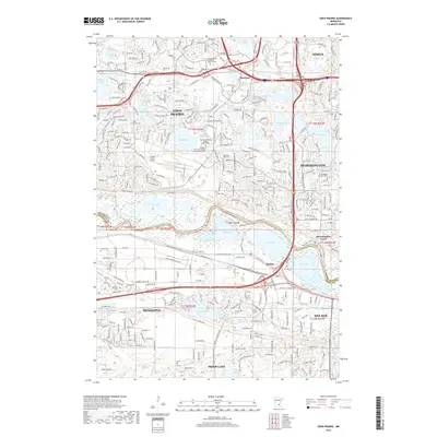
2019 Map of Eden Prairie
USGS Topo · Published 2019About this map
Minnesota River meanders across this suburban landscape, forming the natural boundary between Shakopee and Eden Prairie. The river valley acts as a significant corridor for both transportation and conservation, featuring the Minnesota River Trail and the Blue Lake Trail which trace the wetlands around Blue Lake and Fisher Lake. To the north, the terrain transitions into a densely developed residential and commercial hub, anchored by the Flying Cloud Airport and the expansive grounds of the Hennepin Technical College - Eden-Prairie Campus.
Find a feature on this map
47 named features on this map. Tap any name to fly to it.
Don’t see what you’re looking for? This feature index may not catch every label — zoom into the map to look around manually.
Map Details
Editions of this 2019 Eden Prairie Map
This is the sole edition of this map. No revisions or reprints were ever made.
Other maps of this area

1896 · Minneapolis
USGS Topo · 1:62,500

1901 · Minneapolis
USGS Topo · 1:62,500

1905 · Minnetonka
USGS Topo · 1:62,500

1907 · Minnetonka
USGS Topo · 1:62,500

1952 · Minneapolis South
USGS Topo · 1:24,000

1953 · Saint Paul
USGS Topo · 1:250,000

1954 · Hopkins
USGS Topo · 1:24,000

1954 · Bloomington
USGS Topo · 1:24,000

1954 · Eden Prairie
USGS Topo · 1:24,000

1954 · Minneapolis
USGS Topo · 1:62,500