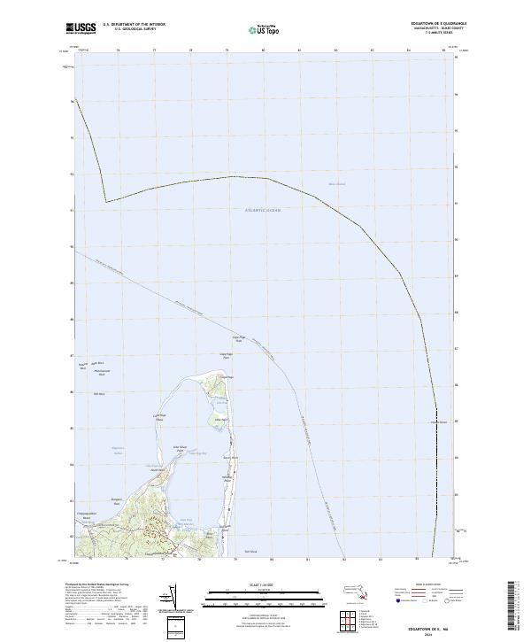
2024 Map of Edgartown OE E
USGS Topo · Published 2024About this map
Chappaquiddick Island defines this coastal landscape, where the shifting sands and tidal marshes of the Atlantic Ocean meet the eastern edge of Martha's Vineyard. This 2024 survey captures the intricate shoreline of Cape Poge, including the slender northern barrier that separates Cape Poge Bay from the open sea. Marine navigation is a central theme of the region, marked by the prominent Oak Bluffs - Nantucket Ferry route crossing the northern waters and the presence of significant hazards like Hawes Shoal.
Find a feature on this map
37 named features on this map. Tap any name to fly to it.
Don’t see what you’re looking for? This feature index may not catch every label — zoom into the map to look around manually.
Map Details
Editions of this 2024 Edgartown OE E Map
This is the sole edition of this map. No revisions or reprints were ever made.
Other maps of this area

1886 · Falmouth
USGS Topo · 1:62,500

1887 · Muskeget
USGS Topo · 1:62,500

1887 · Marthas Vineyard
USGS Topo · 1:62,500

1888 · Falmouth
USGS Topo · 1:62,500

1889 · Muskeget
USGS Topo · 1:62,500

1889 · Marthas Vineyard
USGS Topo · 1:62,500

1893 · Muskeget
USGS Topo · 1:62,500

1893 · Falmouth
USGS Topo · 1:62,500

1894 · Marthas Vineyard
USGS Topo · 1:62,500

1899 · Muskeget
USGS Topo · 1:62,500