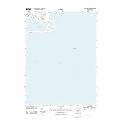
2012 Map of Edgartown OE SE
USGS Topo · Published 2012About this map
Washaqua Hill stands as a prominent elevation overlooking the complex coastal barrier systems of Chappaquiddick during this 2012 survey. The landscape is defined by the narrow, shifting connection of Norton Point separating Katama Bay from the Atlantic Ocean. This era shows a network of local thoroughfares such as Old Indian Trl and Pocha Rd providing access to the more secluded reaches of the island. Significant maritime hazards and landforms shape the eastern edge of the quadrangle, including the submerged Mutton Shoal and the notable Dike Bridge crossing near Pocha Pond. The map serves as a precise record of the shoreline configuration at Wasque Point and the exposed stretch of East Beach before subsequent seasonal erosion and tidal shifts altered these sensitive landforms.
Find a feature on this map
35 named features on this map. Tap any name to fly to it.
Don’t see what you’re looking for? This feature index may not catch every label — zoom into the map to look around manually.
Map Details
Editions of this 2012 Edgartown OE SE Map
This is the sole edition of this map. No revisions or reprints were ever made.
Other maps of this area

1887 · Muskeget
USGS Topo · 1:62,500

1887 · Marthas Vineyard
USGS Topo · 1:62,500

1889 · Muskeget
USGS Topo · 1:62,500

1889 · Marthas Vineyard
USGS Topo · 1:62,500

1893 · Muskeget
USGS Topo · 1:62,500

1894 · Marthas Vineyard
USGS Topo · 1:62,500

1899 · Muskeget
USGS Topo · 1:62,500

1942 · Marthas Vineyard
USGS Topo · 1:125,000

1942 · Nantucket
USGS Topo · 1:125,000
1944 · Edgartown
USGS Topo · 1:31,680