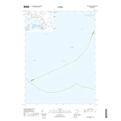
2018 Map of Edgartown OE SE
USGS Topo · Published 2018About this map
Pocha Pond and the surrounding coastal wetlands dominate this maritime landscape on the southeastern edge of Martha's Vineyard. The map detail highlights the delicate interface between land and sea, where Katama Bay Marshes give way to the open Atlantic Ocean. Inland, a network of residential lanes like Sand Plain Way and Trustees Ln weaves through the sandy terrain leading toward Wasque Point.
Find a feature on this map
27 named features on this map. Tap any name to fly to it.
Don’t see what you’re looking for? This feature index may not catch every label — zoom into the map to look around manually.
Map Details
Editions of this 2018 Edgartown OE SE Map
This is the sole edition of this map. No revisions or reprints were ever made.
Other maps of this area

1887 · Muskeget
USGS Topo · 1:62,500

1887 · Marthas Vineyard
USGS Topo · 1:62,500

1889 · Muskeget
USGS Topo · 1:62,500

1889 · Marthas Vineyard
USGS Topo · 1:62,500

1893 · Muskeget
USGS Topo · 1:62,500

1894 · Marthas Vineyard
USGS Topo · 1:62,500

1899 · Muskeget
USGS Topo · 1:62,500

1942 · Marthas Vineyard
USGS Topo · 1:125,000

1942 · Nantucket
USGS Topo · 1:125,000
1944 · Edgartown
USGS Topo · 1:31,680