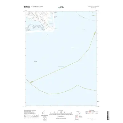
2021 Map of Edgartown OE SE
USGS Topo · Published 2021About this map
Wasque Point and the coastal interface of Chappaquiddick Island define this maritime landscape, where the shifting sands of East Beach meet the open Atlantic Ocean. The map documents a fragile coastal environment characterized by the Katama Bay Marshes and the enclosed waters of Pocha Pond. A network of local roads and paths, such as Litchfield Rd and Pocha Rd, provides access to the shoreline, while the crossing at Dike Bridge remains a critical point of local geography. Off the coast, the deep Muskeget Channel separates the island from the shoals of the Nantucket Sound, with the Oak Bluffs - Nantucket Ferry route cutting through the northern waters. This modern survey provides a baseline for tracking coastal erosion and sand migration near hazardous navigational features like Wasque Shoal and Mutton Shoal.
Find a feature on this map
27 named features on this map. Tap any name to fly to it.
Don’t see what you’re looking for? This feature index may not catch every label — zoom into the map to look around manually.
Map Details
Editions of this 2021 Edgartown OE SE Map
This is the sole edition of this map. No revisions or reprints were ever made.
Other maps of this area

1887 · Muskeget
USGS Topo · 1:62,500

1887 · Marthas Vineyard
USGS Topo · 1:62,500

1889 · Muskeget
USGS Topo · 1:62,500

1889 · Marthas Vineyard
USGS Topo · 1:62,500

1893 · Muskeget
USGS Topo · 1:62,500

1894 · Marthas Vineyard
USGS Topo · 1:62,500

1899 · Muskeget
USGS Topo · 1:62,500

1942 · Marthas Vineyard
USGS Topo · 1:125,000

1942 · Nantucket
USGS Topo · 1:125,000
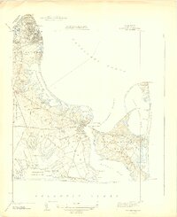
1944 · Edgartown
USGS Topo · 1:31,680