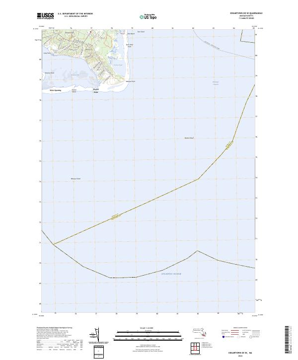
2024 Map of Edgartown OE SE
USGS Topo · Published 2024About this map
Coastal dynamics and maritime pathways dominate this 2024 coastal survey of Chappaquiddick Island's southeastern reaches. The landscape is defined by the shifting barrier beach at Norton Point and the protected waters of Katama Bay, where the West Opening provides a narrow breach to the open sea. Higher ground appears at Sampson Hill and Washaqua Hill, which offer elevation over the salt marshes and ponds that characterize the interior. This map records the intricate network of residential lanes and coastal access points such as Litchfield Rd and Pocha Rd.
Find a feature on this map
35 named features on this map. Tap any name to fly to it.
Don’t see what you’re looking for? This feature index may not catch every label — zoom into the map to look around manually.
Map Details
Editions of this 2024 Edgartown OE SE Map
This is the sole edition of this map. No revisions or reprints were ever made.
Other maps of this area

1887 · Muskeget
USGS Topo · 1:62,500

1887 · Marthas Vineyard
USGS Topo · 1:62,500

1889 · Muskeget
USGS Topo · 1:62,500

1889 · Marthas Vineyard
USGS Topo · 1:62,500

1893 · Muskeget
USGS Topo · 1:62,500

1894 · Marthas Vineyard
USGS Topo · 1:62,500

1899 · Muskeget
USGS Topo · 1:62,500

1942 · Marthas Vineyard
USGS Topo · 1:125,000

1942 · Nantucket
USGS Topo · 1:125,000
1944 · Edgartown
USGS Topo · 1:31,680