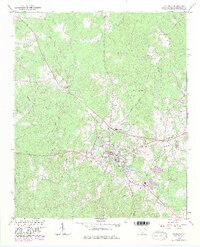
1964 Map of Edgefield
USGS Topo · Published 1982About this map
Edgefield serves as the focal point of this South Carolina study, where the Southern railroad line intersects with local trade routes. The town is surrounded by a dense network of country churches and burial grounds that define the social fabric of the era, including Macedonia Ch and Republican Grove Ch. To the north, the landscape is divided by the drainages of Turkey Creek and Log Creek, while the County Prison Camp and Parker Sch mark the institutional footprint on the land. The presence of Slade Lake and the Waterworks near the town center indicates the critical infrastructure supporting this growing community. Genealogists will find a high density of family-named sites, from the Simkin Cem to Huets Crossroads, providing a clear look at the settled territory before later twentieth-century development altered the outskirts of the county seat.
Find a feature on this map
40 named features on this map. Tap any name to fly to it.
Don’t see what you’re looking for? This feature index may not catch every label — zoom into the map to look around manually.
Map Details
Editions of this 1964 Edgefield Map
3 editions found
Other maps of this area

1892 · Mc Cormick
USGS Topo · 1:125,000

1912 · Mc Cormick
USGS Topo · 1:125,000

1920 · Clarks Hill
USGS Topo · 1:48,000

1921 · Clarks Hill
USGS Topo · 1:62,500

1923 · Warrenville
USGS Topo · 1:48,000

1928 · Warrenville
USGS Topo · 1:62,500

1941 · Clarks Hill
USGS Topo · 1:62,500

1942 · Clarks Hill
USGS Topo · 1:62,500

1943 · Warrenville
USGS Topo · 1:62,500

1953 · Athens
USGS Topo · 1:250,000