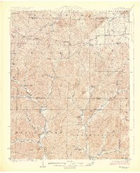
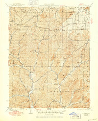
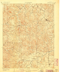
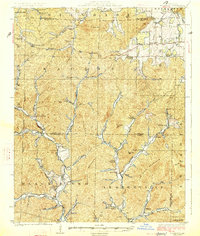
1926 Map of Edgehill
USGS Topo · Published 1926About this map
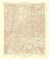
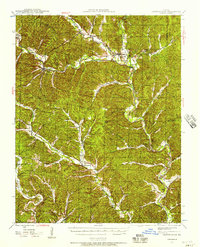
Edgehill and the surrounding Ozark highlands are defined by the winding course of the Black River and its numerous tributaries during the mid-1920s. This survey by J.B. Leavitt reveals a dispersed settlement pattern centered on community landmarks like the Mountainville Store and industrial sites such as Maxwells Mill. The landscape is a network of ridges and deep hollows, including Peter Cave Hollow and Womble Hollow, which dictated the placement of small rural centers like Redmondville, Shepard, and Enough.
Find a feature on this map
73 named features on this map. Tap any name to fly to it.
Don’t see what you’re looking for? This feature index may not catch every label — zoom into the map to look around manually.
Map Details
Editions of this 1926 Edgehill Map
3 editions found
Other maps of this area

1905 · Bonneterre
USGS Topo · 1:62,500
1906 · Potosi
USGS Topo · 1:62,500

1924 · Edgehill
USGS Topo · 1:62,500
1926 · Edgehill
USGS Topo · 1:62,500
1926 · Des Arc
USGS Topo · 1:62,500
1929 · Des Arc
USGS Topo · 1:62,500
1937 · Ironton
USGS Topo · 1:48,000
1943 · Berryman
USGS Topo · 1:62,500
1943 · Lesterville
USGS Topo · 1:62,500
1943 · Boss
USGS Topo · 1:62,500