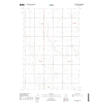
2017 Map of Edgeley Junction
USGS Topo · Published 2017About this map
Edgeley Junction sits at the southern edge of this LaMoure County landscape, where the prairie is defined by the winding paths of Maple Cr and Cottonwood Cr. The 2017 terrain shows a strictly organized grid of agricultural section lines, including Co Rd 34 and numerous numbered routes like 82nd Ave SE and 68th St SE. These roads segment the drainage basins of the two creeks, which meander through the township boundaries of t134n r64w and t135n r63w. The map illustrates a rural North Dakota environment where the natural hydrology of the creek beds dictates the only breaks in the geometric precision of the township and range system.
Find a feature on this map
21 named features on this map. Tap any name to fly to it.
Don’t see what you’re looking for? This feature index may not catch every label — zoom into the map to look around manually.
Map Details
Editions of this 2017 Edgeley Junction Map
This is the sole edition of this map. No revisions or reprints were ever made.
Other maps of this area

1896 · Jamestown
USGS Topo · 1:125,000

1896 · Edgeley
USGS Topo · 1:125,000

1925 · Edgeley
USGS Topo · 1:125,000

1953 · Jamestown
USGS Topo · 1:250,000

1953 · Adrian
USGS Topo · 1:24,000

1953 · Nortonville
USGS Topo · 1:24,000

1953 · Jud SE
USGS Topo · 1:24,000

1956 · Jamestown
USGS Topo · 1:250,000

1982 · Deisem
USGS Topo · 1:24,000
1982 · Kulm-Edgeley Dam
USGS Topo · 1:24,000