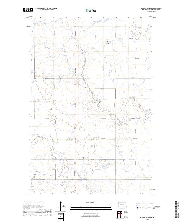
2024 Map of Edgeley Junction
USGS Topo · Published 2024About this map
Cottonwood Creek meanders southeastward through this prairie landscape, defining the local hydrology alongside the smaller Maple Creek. This agricultural region in LaMoure County is characterized by its organized section-line road network, including thoroughfares like Co Rd 34 and 82nd Ave SE. A significant portion of the terrain is dedicated to the Lamoure County Waterfowl Production Area, which preserves vital wetland habitats within the cultivated fields. The map documents the persistent township and range system, specifically detailing t135n r64w and t134n r64w, reflecting the long-standing land division patterns of North Dakota. For those researching family land or local environmental changes, the precise placement of roads and waterways provides a clear look at the contemporary rural structure.
Find a feature on this map
21 named features on this map. Tap any name to fly to it.
Don’t see what you’re looking for? This feature index may not catch every label — zoom into the map to look around manually.
Map Details
Editions of this 2024 Edgeley Junction Map
This is the sole edition of this map. No revisions or reprints were ever made.
Other maps of this area

1896 · Jamestown
USGS Topo · 1:125,000

1896 · Edgeley
USGS Topo · 1:125,000

1925 · Edgeley
USGS Topo · 1:125,000

1953 · Jamestown
USGS Topo · 1:250,000

1953 · Adrian
USGS Topo · 1:24,000

1953 · Nortonville
USGS Topo · 1:24,000

1953 · Jud SE
USGS Topo · 1:24,000

1956 · Jamestown
USGS Topo · 1:250,000

1982 · Deisem
USGS Topo · 1:24,000
1982 · Kulm-Edgeley Dam
USGS Topo · 1:24,000