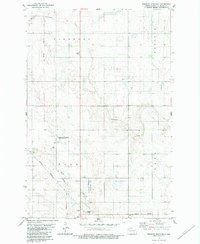
1982 Map of Edgeley Junction
USGS Topo · Published 1983About this map
Cottonwood Creek and Maple Creek meander through this prairie landscape in LaMoure County, defining the drainage patterns of the Glenmore, Russell, Nora, and Waano civil townships. The map documents a transition in transportation, showing the active Burlington Northern Railroad alongside an Old Grade, reflecting the changing rail infrastructure of the late 20th century. At Edgeley Junction, the convergence of these routes marks a historic point of local connectivity.
Find a feature on this map
16 named features on this map. Tap any name to fly to it.
Don’t see what you’re looking for? This feature index may not catch every label — zoom into the map to look around manually.
Map Details
Editions of this 1982 Edgeley Junction Map
This is the sole edition of this map. No revisions or reprints were ever made.
Other maps of this area

1896 · Jamestown
USGS Topo · 1:125,000

1896 · Edgeley
USGS Topo · 1:125,000

1925 · Edgeley
USGS Topo · 1:125,000

1953 · Jamestown
USGS Topo · 1:250,000

1953 · Adrian
USGS Topo · 1:24,000

1953 · Nortonville
USGS Topo · 1:24,000

1953 · Jud SE
USGS Topo · 1:24,000

1956 · Jamestown
USGS Topo · 1:250,000

1982 · Deisem
USGS Topo · 1:24,000
1982 · Kulm-Edgeley Dam
USGS Topo · 1:24,000