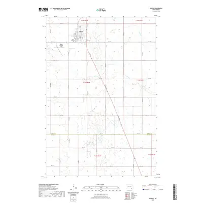
2020 Map of Edgeley
USGS Topo · Published 2020About this map
Edgeley anchors this 2020 topographic landscape, situated at the intersection of local routes and the modern township lines of t134n r64w and t133n r64w. The town’s grid is clearly defined, with 1st Ave and several numbered streets and avenues leading toward the Edgeley Municipal Airport to the west. On the southwestern edge of the settlement, Mount Hope Cem and Mount Calvary Cem provide significant points of reference for local genealogical research and family history.
Find a feature on this map
40 named features on this map. Tap any name to fly to it.
Don’t see what you’re looking for? This feature index may not catch every label — zoom into the map to look around manually.
Map Details
Editions of this 2020 Edgeley Map
This is the sole edition of this map. No revisions or reprints were ever made.
Other maps of this area

1894 · Monango
USGS Topo · 1:62,500

1896 · Edgeley
USGS Topo · 1:125,000

1925 · Edgeley
USGS Topo · 1:125,000

1953 · Jamestown
USGS Topo · 1:250,000

1956 · Jamestown
USGS Topo · 1:250,000

1971 · Merricourt
USGS Topo · 1:24,000
1982 · Monango NW
USGS Topo · 1:24,000

1982 · Deisem
USGS Topo · 1:24,000
1982 · Kulm-Edgeley Dam
USGS Topo · 1:24,000
1982 · Monango
USGS Topo · 1:24,000