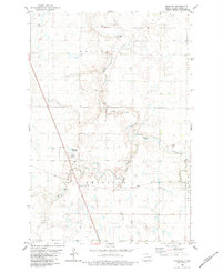
1982 Map of Monango
USGS Topo · Published 1983About this map
The Monango settlement serves as a focal point in this portion of Dickey County, situated where the Soo Line railroad intersects with Highway 281. The landscape is defined by the winding course of the Maple River and its South Fork, which meander through the townships of Valley and Keystone. This late-1970s field-checked environment reveals a rural economy tied to the rail corridor, with small rail-side stops like Boynton and Monango Crossing marking the transport of agricultural goods. Local civic and social life is anchored by a Townhall in the northern hills and a local Cemetery just west of the main village. The presence of numerous Gravel Pits along the river valleys indicates the importance of local material extraction for the region's road and rail infrastructure during this era.
Find a feature on this map
15 named features on this map. Tap any name to fly to it.
Don’t see what you’re looking for? This feature index may not catch every label — zoom into the map to look around manually.
Map Details
Editions of this 1982 Monango Map
This is the sole edition of this map. No revisions or reprints were ever made.
Other maps of this area

1894 · Monango
USGS Topo · 1:62,500

1894 · La Moure
USGS Topo · 1:62,500

1894 · Fullerton
USGS Topo · 1:62,500

1895 · Lamoure
USGS Topo · 1:125,000

1896 · Edgeley
USGS Topo · 1:125,000

1918 · La Moure
USGS Topo · 1:125,000

1925 · Edgeley
USGS Topo · 1:125,000

1953 · Jamestown
USGS Topo · 1:250,000

1956 · Jamestown
USGS Topo · 1:250,000
1956 · Ellendale North
USGS Topo · 1:24,000