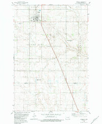
1982 Map of Edgeley
USGS Topo · Published 1986About this map
Edgeley serves as the primary hub of activity in this section of the Great Plains, where the grid of town streets meets the open prairie. The landscape is characterized by a high density of small kettle ponds and wetlands, many of which are protected within the National Waterfowl Production Area. This conservation focus is balanced by the infrastructure of a working rural community, including the Edgeley Airport and the Hartwig Landing Strip, which reflect the region's reliance on aviation for transit and agriculture.
Find a feature on this map
19 named features on this map. Tap any name to fly to it.
Don’t see what you’re looking for? This feature index may not catch every label — zoom into the map to look around manually.
Map Details
Editions of this 1982 Edgeley Map
This is the sole edition of this map. No revisions or reprints were ever made.
Other maps of this area

1894 · Monango
USGS Topo · 1:62,500

1896 · Edgeley
USGS Topo · 1:125,000

1925 · Edgeley
USGS Topo · 1:125,000

1953 · Jamestown
USGS Topo · 1:250,000

1956 · Jamestown
USGS Topo · 1:250,000

1971 · Merricourt
USGS Topo · 1:24,000
1982 · Monango NW
USGS Topo · 1:24,000

1982 · Deisem
USGS Topo · 1:24,000
1982 · Kulm-Edgeley Dam
USGS Topo · 1:24,000
1982 · Monango
USGS Topo · 1:24,000