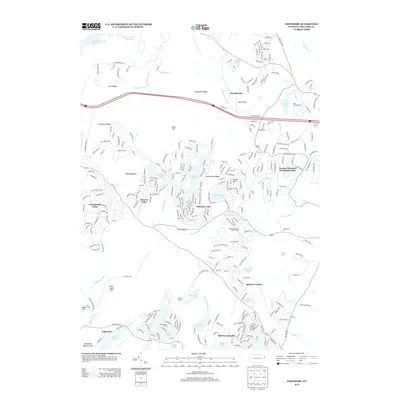
2013 Map of Edgemere
USGS Topo · Published 2013About this map
Edgemere and Frenchtown anchor a landscape defined by an intricate network of residential lake communities and recreational camps in this corner of Pike County. The region’s 21st-century character is shaped by planned developments such as Pocono Mountain Woodland Lakes, Marcel Lake Estate, and Birchwood Lakes, which transformed the wooded hills into a mosaic of seasonal and year-round homes. Waterways like Dwarfs Kill and Adams Creek flow through the varied terrain, punctuated by features like Aces Ridge and Tarburner Ridge. Local transport and social hubs include Myer Airport and Spencer Corner. The presence of New Jersey Camp and Camp Speers emphasizes the area's long-standing role as a mountain retreat. This record preserves the footprint of these complex upland settlements as they appeared following decades of suburban growth in the Poconos.
Find a feature on this map
297 named features on this map. Tap any name to fly to it.
Don’t see what you’re looking for? This feature index may not catch every label — zoom into the map to look around manually.
Map Details
Editions of this 2013 Edgemere Map
This is the sole edition of this map. No revisions or reprints were ever made.
Other maps of this area

1891 · Wallpack
USGS Topo · 1:62,500

1893 · Wallpack
USGS Topo · 1:62,500

1913 · Milford
USGS Topo · 1:62,500

1915 · Milford
USGS Topo · 1:62,500

1924 · Bushkill
USGS Topo · 1:48,000

1935 · Hawley
USGS Topo · 1:62,500

1938 · Hawley
USGS Topo · 1:62,500

1943 · Bushkill
USGS Topo · 1:62,500

1943 · Lake Maskenozha
USGS Topo · 1:31,680
1943 · Culvers Gap
USGS Topo · 1:31,680
Featured Places
- Blooming Grove Township, PA
- Shohola Township, PA
- Milford Township, PA
- Dingman Township, PA
- Edgemere, Delaware Township