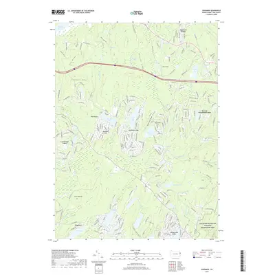
2019 Map of Edgemere
USGS Topo · Published 2019About this map
Edgemere and a network of residential lake communities define this Pike County landscape during the late twenty-first century. The map illustrates a distinctive pattern of development where private enclaves like Conashaugh Lakes, Sagamore Estates, and Pocono Woodland Lakes are interwoven with protected natural spaces. Significant portions of the southeastern quadrant are preserved within the Delaware Water Gap National Recreation Area, contrasting with the dense street grids of nearby settlements.
Find a feature on this map
227 named features on this map. Tap any name to fly to it.
Don’t see what you’re looking for? This feature index may not catch every label — zoom into the map to look around manually.
Map Details
Editions of this 2019 Edgemere Map
This is the sole edition of this map. No revisions or reprints were ever made.
Other maps of this area

1891 · Wallpack
USGS Topo · 1:62,500

1893 · Wallpack
USGS Topo · 1:62,500

1913 · Milford
USGS Topo · 1:62,500

1915 · Milford
USGS Topo · 1:62,500

1924 · Bushkill
USGS Topo · 1:48,000

1935 · Hawley
USGS Topo · 1:62,500

1938 · Hawley
USGS Topo · 1:62,500

1943 · Bushkill
USGS Topo · 1:62,500

1943 · Lake Maskenozha
USGS Topo · 1:31,680
1943 · Culvers Gap
USGS Topo · 1:31,680
Featured Places
- Blooming Grove Township, PA
- Shohola Township, PA
- Milford Township, PA
- Dingman Township, PA
- Edgemere, Delaware Township