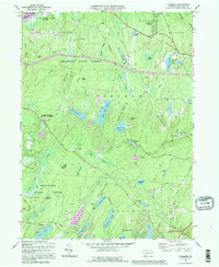
1992 Map of Edgemere
USGS Topo · Published 1995About this map
The settlement of Edgemere and the surrounding wilderness of the Delaware State Forest define this landscape in the Poconos. A network of youth camps and summer retreats including Camp Speers, Camp Nassau, and the New Jersey Camp are scattered across the terrain, reflecting the area's mid-century development as a recreational destination. Numerous glacial water bodies, from the prominent Gold Key Lake and Sunrise Lake to the smaller Log Tavern Pond, are fed by a complex system of brooks and swamps such as Nichecronk Brook and Dark Swamp.
Find a feature on this map
61 named features on this map. Tap any name to fly to it.
Don’t see what you’re looking for? This feature index may not catch every label — zoom into the map to look around manually.
Map Details
Editions of this 1992 Edgemere Map
This is the sole edition of this map. No revisions or reprints were ever made.
Other maps of this area

1891 · Wallpack
USGS Topo · 1:62,500

1893 · Wallpack
USGS Topo · 1:62,500

1913 · Milford
USGS Topo · 1:62,500

1915 · Milford
USGS Topo · 1:62,500

1924 · Bushkill
USGS Topo · 1:48,000

1935 · Hawley
USGS Topo · 1:62,500

1938 · Hawley
USGS Topo · 1:62,500

1943 · Bushkill
USGS Topo · 1:62,500

1943 · Lake Maskenozha
USGS Topo · 1:31,680
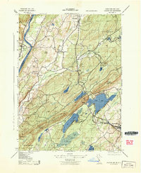
1943 · Culvers Gap
USGS Topo · 1:31,680
Featured Places
- Blooming Grove Township, PA
- Shohola Township, PA
- Birchwood Lakes, Delaware Township
- Delaware Township, PA
- Dingman Township, PA