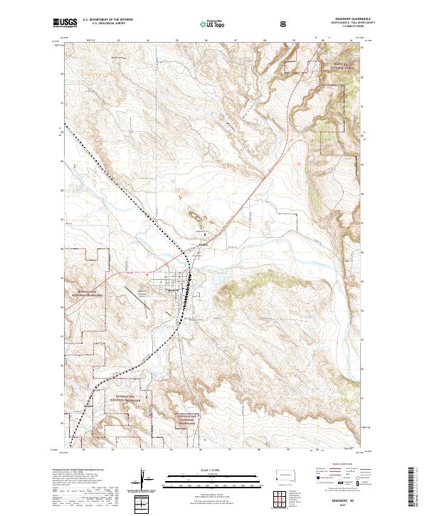
2021 Map of Edgemont
USGS Topo · Published 2021About this map
The Cheyenne River winds through this South Dakota landscape, creating a geographic focal point for the city of Edgemont and the nearby settlement of Dudley. This region in Fall River County is defined by the meeting of protected public lands, where the Black Hills National Forest descends into the expansive Buffalo Gap National Grassland. The local infrastructure is shaped by the river valley, with the George S Mickelson Trl and the Edgemont Municipal Airport serving as key transportation landmarks. To the south, the terrain follows Cottonwood Cr near the community of Dennis, while northern elevations are marked by features like Breakneck Hill and the steep descents of Red Canyon and Stone Quarry Canyon.
Find a feature on this map
41 named features on this map. Tap any name to fly to it.
Don’t see what you’re looking for? This feature index may not catch every label — zoom into the map to look around manually.
Map Details
Editions of this 2021 Edgemont Map
This is the sole edition of this map. No revisions or reprints were ever made.
Other maps of this area

1902 · Edgemont
USGS Topo · 1:125,000

1950 · Edgemont
USGS Topo · 1:24,000

1950 · Edgemont SW
USGS Topo · 1:24,000

1950 · Rumford
USGS Topo · 1:24,000

1950 · Burdock
USGS Topo · 1:24,000

1950 · Edgemont NE
USGS Topo · 1:24,000

1950 · Minnekahta
USGS Topo · 1:24,000

1950 · Flint Hill
USGS Topo · 1:24,000

1955 · Hot Springs
USGS Topo · 1:250,000
1982 · Provo
USGS Topo · 1:25,000