
1950 Map of Rumford
USGS Topo · Published 1952About this map
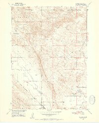
Rumford serves as a lonely outpost along the Chicago Burlington and Quincy railroad line, representing a critical waypoint in the semi-arid landscape of Fall River County. The area’s geography is defined by the sharp transition between the Plains and Plain Valley, where the drainage network of Plum Creek, Piney Creek, and Hat Creek carves through the terrain. The introduction of an Irrigation Canal near the Horse Creek drainage indicates 1950s efforts to manage water for agriculture in this dry environment. To the south, the Christensen Sch provided a central gathering point for ranching families scattered across Squaw Flat and the surrounding rangeland. The map detail highlights several Windmills, essential infrastructure for maintaining livestock where natural water sources were seasonal or unreliable.
Find a feature on this map
15 named features on this map. Tap any name to fly to it.
Don’t see what you’re looking for? This feature index may not catch every label — zoom into the map to look around manually.
Map Details
Editions of this 1950 Rumford Map
3 editions found
Other maps of this area

1902 · Edgemont
USGS Topo · 1:125,000

1950 · Edgemont
USGS Topo · 1:24,000

1950 · Heppner
USGS Topo · 1:24,000

1950 · Cascade Springs
USGS Topo · 1:24,000

1950 · Flint Hill
USGS Topo · 1:24,000

1955 · Hot Springs
USGS Topo · 1:250,000
1982 · Crowe Dam
USGS Topo · 1:25,000
1982 · Provo
USGS Topo · 1:25,000
1982 · Ardmore
USGS Topo · 1:25,000
1982 · Ardmore SE
USGS Topo · 1:25,000