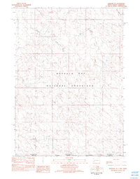
1982 Map of Ardmore SE
USGS Topo · Published 1982About this map
The Buffalo Gap National Grassland dominates the northern half of this landscape, meeting its counterpart, the Oglala National Grassland, at the state line. This borderland region between South Dakota and Nebraska is defined by a dendritic drainage network that includes Hay Creek and the headwaters of Mule Creek. The terrain is characterized by broad draws and hollows, such as the prominent Long Hollow in the northeast and the winding path of Lightning Draw. This 1982 provisional survey records the remote cattle country and public lands before later decades brought changes to grazing management and rural infrastructure. The intersection of Fall River, Sioux, and Dawes counties illustrates the complex administrative geography where the Great Plains transition across state boundaries, with ephemeral waterways like Branch Creek and South Long Hollow Creek providing the primary landmarks in an otherwise open, grassy expanse.
Find a feature on this map
11 named features on this map. Tap any name to fly to it.
Don’t see what you’re looking for? This feature index may not catch every label — zoom into the map to look around manually.
Map Details
Editions of this 1982 Ardmore SE Map
This is the sole edition of this map. No revisions or reprints were ever made.
Other maps of this area

1896 · Oelrichs
USGS Topo · 1:125,000

1900 · Oelrichs
USGS Topo · 1:125,000

1902 · Edgemont
USGS Topo · 1:125,000

1950 · Heppner
USGS Topo · 1:24,000

1950 · Rumford
USGS Topo · 1:24,000

1955 · Hot Springs
USGS Topo · 1:250,000

1955 · Alliance
USGS Topo · 1:250,000

1957 · Alliance
USGS Topo · 1:250,000

1958 · Alliance
USGS Topo · 1:250,000

1980 · Montrose
USGS Topo · 1:24,000