
1950 Map of Edgemont SW
USGS Topo · Published 1952About this map
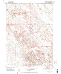
The Cheyenne River winds through the northeastern corner of this 1950 survey, defining a landscape shaped by water management and transit in Fall River County. The small settlement of Dudley sits near the riverbanks, where the Chicago Burlington and Quincy railroad tracks provide a vital transport link. The intricate network of the Irrigation Canal and the presence of an Abandoned Canal suggest a history of evolving agricultural engineering as settlers attempted to harness the local waterways. Further south, Fiddle Creek Dam and the confluence of Fiddle Creek and Cottonwood Creek highlight the importance of these seasonal drainages. From the flats of Cottonwood to the northern reaches of Tubbs, the map illustrates a rural South Dakota territory where survival and industry were closely tied to the erratic flow of the plains' creek systems.
Find a feature on this map
14 named features on this map. Tap any name to fly to it.
Don’t see what you’re looking for? This feature index may not catch every label — zoom into the map to look around manually.
Map Details
Editions of this 1950 Edgemont SW Map
2 editions found
Other maps of this area

1902 · Edgemont
USGS Topo · 1:125,000

1950 · Edgemont
USGS Topo · 1:24,000

1950 · Burdock
USGS Topo · 1:24,000

1950 · Edgemont NE
USGS Topo · 1:24,000

1951 · Twentyone Divide
USGS Topo · 1:24,000

1955 · Hot Springs
USGS Topo · 1:250,000

1955 · Newcastle
USGS Topo · 1:250,000

1958 · Newcastle
USGS Topo · 1:250,000

1978 · Coffee Flats
USGS Topo · 1:24,000
1978 · Mule Creek SE
USGS Topo · 1:24,000