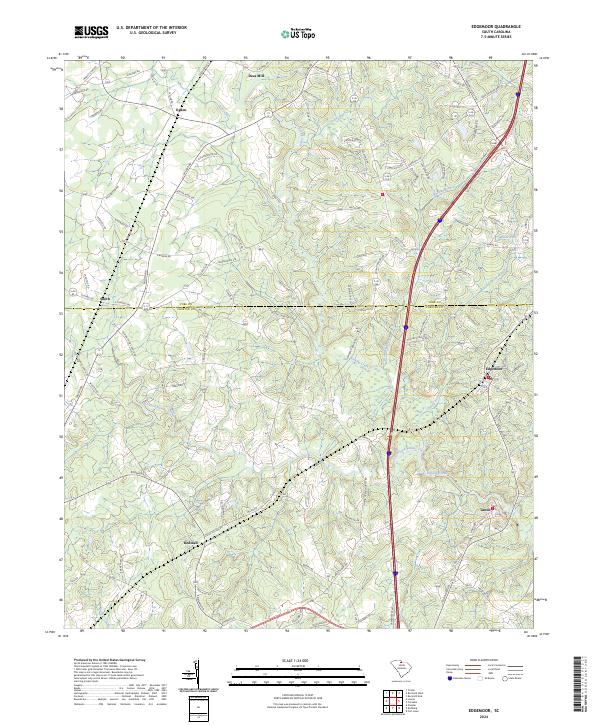
2024 Map of Edgemoor
USGS Topo · Published 2024About this map
Fishing Creek and its many tributaries, including South Fork Fishing Creek and Stony Fork, define the rolling landscape across the border of York and Chester Counties. This contemporary survey captures the modern road networks that link established communities such as Edgemoor and Lando. The placement of Deas Mill in the northern reach suggests the long-standing importance of water power and milling in this Piedmont drainage basin, while the settlements of Ogden, Rodman, and Smith serve as key points for local genealogy and land-use research.
Find a feature on this map
104 named features on this map. Tap any name to fly to it.
Don’t see what you’re looking for? This feature index may not catch every label — zoom into the map to look around manually.
Map Details
Editions of this 2024 Edgemoor Map
This is the sole edition of this map. No revisions or reprints were ever made.
Other maps of this area

1941 · Spartanburg
USGS Topo · 1:250,000

1949 · Rock Hill
USGS Topo · 1:62,500

1953 · Spartanburg
USGS Topo · 1:250,000

1960 · Spartanburg
USGS Topo · 1:250,000

1963 · Spartanburg
USGS Topo · 1:250,000

1964 · Spartanburg
USGS Topo · 1:250,000

1968 · Catawba
USGS Topo · 1:24,000
1968 · Rock Hill East
USGS Topo · 1:24,000
1969 · Fort Lawn
USGS Topo · 1:24,000
1969 · Richburg
USGS Topo · 1:24,000