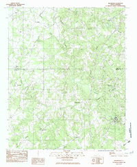
1982 Map of Edgemoor
USGS Topo · Published 1983About this map
Fishing Creek and its southern fork carve a complex network of valleys through this section of the Piedmont during the early 1980s. The landscape is defined by rural community life, anchored by numerous country churches such as Antioch Ch, Cedar Grove Ch, and Rehoboth Ch. Small settlements like Edgemoor and Lando serve as local hubs, while the former Crawford Community Center stands as a focal point for the surrounding farms.
Find a feature on this map
27 named features on this map. Tap any name to fly to it.
Don’t see what you’re looking for? This feature index may not catch every label — zoom into the map to look around manually.
Map Details
Editions of this 1982 Edgemoor Map
This is the sole edition of this map. No revisions or reprints were ever made.
Other maps of this area

1941 · Spartanburg
USGS Topo · 1:250,000

1949 · Rock Hill
USGS Topo · 1:62,500

1953 · Spartanburg
USGS Topo · 1:250,000

1960 · Spartanburg
USGS Topo · 1:250,000

1963 · Spartanburg
USGS Topo · 1:250,000

1964 · Spartanburg
USGS Topo · 1:250,000

1968 · Catawba
USGS Topo · 1:24,000
1968 · Rock Hill East
USGS Topo · 1:24,000
1969 · Fort Lawn
USGS Topo · 1:24,000
1969 · Richburg
USGS Topo · 1:24,000