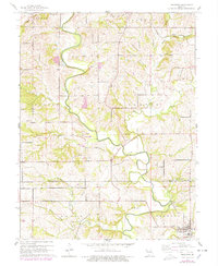
1961 Map of Edgerton
USGS Topo · Published 1978About this map
Edgerton and the surrounding agricultural bottomlands of the Platte River define this mid-century Missouri landscape. The meandering river is flanked by an extensive Levee system, protecting the fertile valleys where Benner Lake and Gamble Lake sit as prominent oxbow remnants. This period shows a rural community anchored by small centers of worship and burial, including Hebron Ch and Davis Chapel, alongside family and local burial grounds like Union Mill Cem and Bristol Cem.
Find a feature on this map
34 named features on this map. Tap any name to fly to it.
Don’t see what you’re looking for? This feature index may not catch every label — zoom into the map to look around manually.
Map Details
Editions of this 1961 Edgerton Map
2 editions found
Other maps of this area

1890 · Kansas City
USGS Topo · 1:125,000

1894 · Kansas City
USGS Topo · 1:125,000

1910 · Leavenworth
USGS Topo · 1:62,500

1914 · Smithville
USGS Topo · 1:62,500

1925 · Gower
USGS Topo · 1:62,500

1927 · Dearborn
USGS Topo · 1:62,500

1948 · Leavenworth
USGS Topo · 1:62,500

1950 · Kansas City
USGS Topo · 1:250,000
1950 · Smithville
USGS Topo · 1:62,500
1951 · Smithville
USGS Topo · 1:24,000