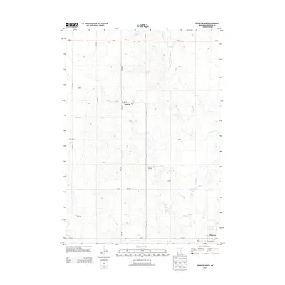
2013 Map of Edgerton North
USGS Topo · Published 2013About this map
The Coteau des Prairies, a high glacial plateau, defines the topography of this Pipestone County landscape. The drainage of the Rock River and Chanarambie Cr carves through the terrain, supporting a network of agricultural operations including Shaffer Farms, Newalta Dairy, and Ranger Farms. The town of Edgerton sits at the southern edge of the survey, anchored by its Hillside Cem and local Po. To the northwest, the small settlement of Hatfield marks a crossroads along the grid of township roads. This area reflects the late twentieth-century shift toward large-scale agricultural infrastructure, evidenced by named dairy and farm properties that have become geographic landmarks alongside traditional burial grounds like Trosky Cem.
Find a feature on this map
29 named features on this map. Tap any name to fly to it.
Don’t see what you’re looking for? This feature index may not catch every label — zoom into the map to look around manually.
Map Details
Editions of this 2013 Edgerton North Map
This is the sole edition of this map. No revisions or reprints were ever made.
Other maps of this area

1953 · Watertown
USGS Topo · 1:250,000

1955 · Sioux Falls
USGS Topo · 1:250,000

1958 · Sioux Falls
USGS Topo · 1:250,000

1958 · Watertown
USGS Topo · 1:250,000

1967 · Edgerton South
USGS Topo · 1:24,000

1967 · Pipestone North
USGS Topo · 1:24,000

1967 · Edgerton North
USGS Topo · 1:24,000

1967 · Edgerton NE
USGS Topo · 1:24,000

1967 · Kenneth
USGS Topo · 1:24,000
1967 · Woodstock
USGS Topo · 1:24,000