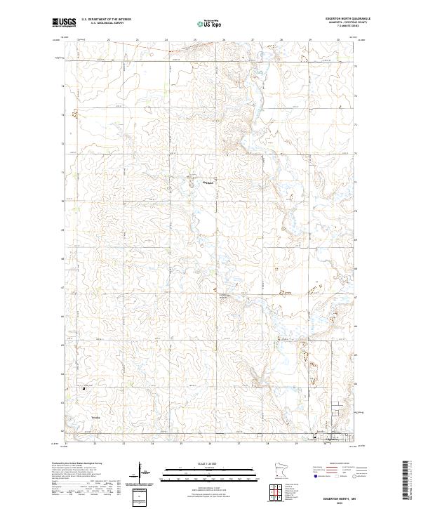
2022 Map of Edgerton North
USGS Topo · Published 2022About this map
The Coteau des Prairies, a high glacial plateau, provides the distinct elevation profile for this region of Pipestone County. The Rock River meanders southward through the eastern half of the map, carving a drainage path toward the settlement of Edgerton. To the west, the village of Trosky and the hamlet of Hatfield are linked by a grid of agricultural section roads including 101st St and 21st St. Genealogists will find the Trosky Cem and Hillside Cem clearly marked near their respective towns. The presence of the Casey Jones State Trl in the northern sections follows a historic transportation corridor across the prairie, reflecting the transition from pioneer rail routes to modern recreational use in a landscape still dominated by organized township farming.
Find a feature on this map
38 named features on this map. Tap any name to fly to it.
Don’t see what you’re looking for? This feature index may not catch every label — zoom into the map to look around manually.
Map Details
Editions of this 2022 Edgerton North Map
This is the sole edition of this map. No revisions or reprints were ever made.
Other maps of this area

1953 · Watertown
USGS Topo · 1:250,000

1955 · Sioux Falls
USGS Topo · 1:250,000

1958 · Sioux Falls
USGS Topo · 1:250,000

1958 · Watertown
USGS Topo · 1:250,000

1967 · Edgerton South
USGS Topo · 1:24,000

1967 · Pipestone North
USGS Topo · 1:24,000

1967 · Edgerton North
USGS Topo · 1:24,000

1967 · Edgerton NE
USGS Topo · 1:24,000

1967 · Kenneth
USGS Topo · 1:24,000
1967 · Woodstock
USGS Topo · 1:24,000