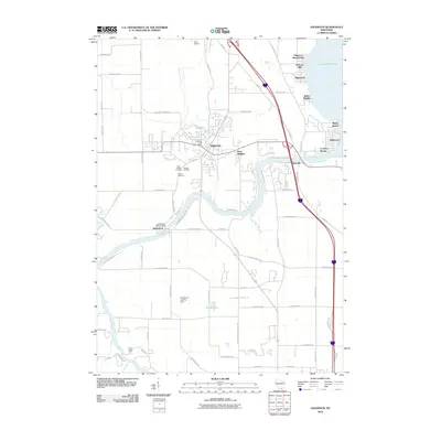
2010 Map of Edgerton
USGS Topo · Published 2010About this map
The Rock River carves a winding path through this portion of southern Wisconsin, connecting the village of Edgerton and the waters of Lake Koshkonong. In the northern half of the map, several residential lakefront communities such as Highwood, Hickory Hills, and Indian Heights line the southwestern shore of the lake. The terrain is marked by the industrial and civic presence of the Edgerton Post Office and the suburban layout of Hans Addition. To the south, the Indianford WD-60 Dam regulates the river's flow near the settlement of Indianford, a location of interest for those tracking local water management history.
Find a feature on this map
73 named features on this map. Tap any name to fly to it.
Don’t see what you’re looking for? This feature index may not catch every label — zoom into the map to look around manually.
Map Details
Editions of this 2010 Edgerton Map
This is the sole edition of this map. No revisions or reprints were ever made.
Other maps of this area

1890 · Stoughton
USGS Topo · 1:62,500

1891 · Koshkonong
USGS Topo · 1:62,500

1891 · Janesville
USGS Topo · 1:62,500

1893 · Janesville
USGS Topo · 1:62,500

1893 · Shopiere
USGS Topo · 1:62,500

1894 · Koshkonong
USGS Topo · 1:62,500

1906 · Koshkonong
USGS Topo · 1:62,500

1954 · Rockford
USGS Topo · 1:250,000

1955 · Rockford
USGS Topo · 1:250,000

1958 · Rockford
USGS Topo · 1:250,000