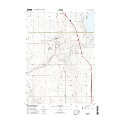
2016 Map of Edgerton
USGS Topo · Published 2016About this map
Edgerton and its surrounding riverine landscape are defined by the convergence of the Rock River and the Yahara River, providing a clear look at the region's topography and settlement patterns in the mid-2010s. The map captures the interface of three counties—Dane, Jefferson, and Rock—where the river system feeds into Lake Koshkonong at Newville and Olsons Bay. This area is a critical node for understanding local hydrology and the development of riverside communities like Indianford.
Find a feature on this map
103 named features on this map. Tap any name to fly to it.
Don’t see what you’re looking for? This feature index may not catch every label — zoom into the map to look around manually.
Map Details
Editions of this 2016 Edgerton Map
This is the sole edition of this map. No revisions or reprints were ever made.
Other maps of this area

1890 · Stoughton
USGS Topo · 1:62,500

1891 · Koshkonong
USGS Topo · 1:62,500

1891 · Janesville
USGS Topo · 1:62,500

1893 · Janesville
USGS Topo · 1:62,500

1893 · Shopiere
USGS Topo · 1:62,500

1894 · Koshkonong
USGS Topo · 1:62,500

1906 · Koshkonong
USGS Topo · 1:62,500

1954 · Rockford
USGS Topo · 1:250,000

1955 · Rockford
USGS Topo · 1:250,000

1958 · Rockford
USGS Topo · 1:250,000