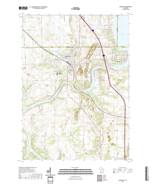
2022 Map of Edgerton
USGS Topo · Published 2022About this map
Edgerton stands as the primary hub at the intersection of Dane and Rock counties, where the city grid meets the winding course of Saunders Cr. To the east, the landscape opens into Lake Koshkonong at Olsons Bay, while the Rock River snakes southward toward the settlement of Indianford. The region's history is well-preserved in its numerous burial grounds, including the Saint Joseph Parish Cem, Fassett Cem, and Jenson Cem, which serve as vital landmarks for genealogists and local historians. Rural roads like Co Hwy M and Stoughton Rd connect the town center to outlier points like Newville and Jana Airport. The terrain is defined by low-lying wetlands and small water bodies such as Willies Pond, reflecting the glaciated character of southern Wisconsin.
Find a feature on this map
121 named features on this map. Tap any name to fly to it.
Don’t see what you’re looking for? This feature index may not catch every label — zoom into the map to look around manually.
Map Details
Editions of this 2022 Edgerton Map
This is the sole edition of this map. No revisions or reprints were ever made.
Other maps of this area

1890 · Stoughton
USGS Topo · 1:62,500

1891 · Koshkonong
USGS Topo · 1:62,500

1891 · Janesville
USGS Topo · 1:62,500

1893 · Janesville
USGS Topo · 1:62,500

1893 · Shopiere
USGS Topo · 1:62,500

1894 · Koshkonong
USGS Topo · 1:62,500

1906 · Koshkonong
USGS Topo · 1:62,500

1954 · Rockford
USGS Topo · 1:250,000

1955 · Rockford
USGS Topo · 1:250,000

1958 · Rockford
USGS Topo · 1:250,000