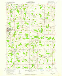
1961 Map of Edgerton
USGS Topo · Published 1962About this map
The St Joseph River defines the western reaches of this Williams County landscape, winding south past the village of Edgerton. This 1961 field-checked survey reveals a rural Ohio community at the intersection of river-driven geography and industrial rail infrastructure. The New York Central railroad cuts a straight line through the center of the sheet, connecting small trackside settlements like Mina and Melbern to the wider region.
Find a feature on this map
35 named features on this map. Tap any name to fly to it.
Don’t see what you’re looking for? This feature index may not catch every label — zoom into the map to look around manually.
Map Details
Editions of this 1961 Edgerton Map
3 editions found
Other maps of this area

1914 · Pioneer
USGS Topo · 1:62,500

1914 · Bryan
USGS Topo · 1:62,500

1940 · Metz
USGS Topo · 1:24,000

1943 · Bryan
USGS Topo · 1:62,500

1944 · Pioneer
USGS Topo · 1:62,500

1953 · Fort Wayne
USGS Topo · 1:250,000

1956 · Fort Wayne
USGS Topo · 1:250,000

1958 · Hicksville
USGS Topo · 1:24,000

1958 · Butler East
USGS Topo · 1:24,000

1960 · Sherwood
USGS Topo · 1:24,000