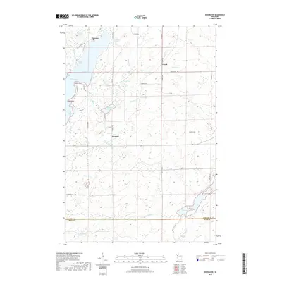
2018 Map of Edgewater
USGS Topo · Published 2018About this map
Lake Chetac dominates the western landscape of this survey, defining a jagged shoreline that includes Badger Bay, Squaw Bay, and The Bullpen Bay. The settlement of Edgewater is positioned at the northern narrows where Heron Lake meets the larger water body, while the interior terrain rises toward Meteor Hill in the east. This region is characterized by a dense network of springs and creeks, including Knuteson Spring and Fortyone Creek Spring, which feed into the complex drainage systems of the Northwoods. The transition between Sawyer Co and Rusk Co is marked along the southern portion of the sheet, providing a precise record of the county line at the time of the survey. Inland, the smaller hamlets of Yarnell and Wooddale are linked by a grid of rural routes such as N Yarnell RD and N Woodale RD, reflecting the post-logging settlement pattern of this part of Wisconsin.
Find a feature on this map
54 named features on this map. Tap any name to fly to it.
Don’t see what you’re looking for? This feature index may not catch every label — zoom into the map to look around manually.
Map Details
Editions of this 2018 Edgewater Map
This is the sole edition of this map. No revisions or reprints were ever made.
Other maps of this area

1944 · Couderay
USGS Topo · 1:48,000

1945 · Meteor
USGS Topo · 1:48,000

1948 · Couderay
USGS Topo · 1:48,000

1948 · Stone Lake
USGS Topo · 1:48,000

1949 · Meteor
USGS Topo · 1:48,000

1949 · Rice Lake
USGS Topo · 1:48,000

1950 · Stone Lake
USGS Topo · 1:48,000

1951 · Rice Lake
USGS Topo · 1:48,000

1953 · Rice Lake
USGS Topo · 1:250,000

1959 · Rice Lake
USGS Topo · 1:250,000