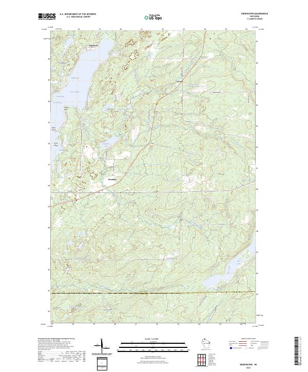
2023 Map of Edgewater
USGS Topo · Published 2023About this map
Lake Chetac dominates the northwestern landscape of this Wisconsin survey, where the settlement of Edgewater sits along its northern shores. The terrain transitions from the water's edge at Badger Bay and Heron Bay to the rising elevation of Meteor Hill in the east. Small communities like Yarnell and Wooddale are linked by a network of local roads and the Tuscobia State Trl, which follows a clear linear corridor through the center of the township.
Find a feature on this map
63 named features on this map. Tap any name to fly to it.
Don’t see what you’re looking for? This feature index may not catch every label — zoom into the map to look around manually.
Map Details
Editions of this 2023 Edgewater Map
This is the sole edition of this map. No revisions or reprints were ever made.
Other maps of this area

1944 · Couderay
USGS Topo · 1:48,000

1945 · Meteor
USGS Topo · 1:48,000

1948 · Couderay
USGS Topo · 1:48,000

1948 · Stone Lake
USGS Topo · 1:48,000

1949 · Meteor
USGS Topo · 1:48,000

1949 · Rice Lake
USGS Topo · 1:48,000

1950 · Stone Lake
USGS Topo · 1:48,000

1951 · Rice Lake
USGS Topo · 1:48,000

1953 · Rice Lake
USGS Topo · 1:250,000

1959 · Rice Lake
USGS Topo · 1:250,000