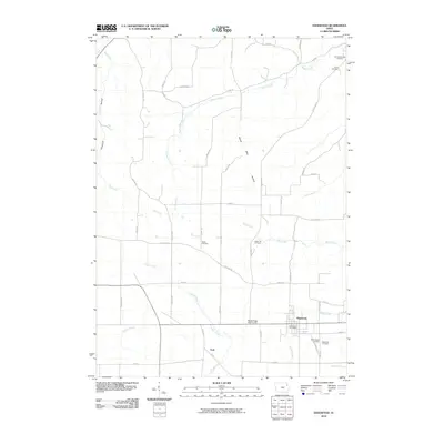
2010 Map of Edgewood
USGS Topo · Published 2010About this map
Edgewood and the nearby settlement of York anchor this 2010 survey of the Iowa landscape. The map reveals a region defined by its drainage patterns, where significant watercourses like Cox Creek, Bear Creek, and Lindsey Creek have carved distinct landforms such as Cox Creek Hollow and Mossy Glen Hollow. This detailed record shows a mature rural infrastructure, with a dense network of local roads including Fortune Ave, Elm RD, and E Mission RD connecting dispersed farmsteads and agricultural plots.
Find a feature on this map
49 named features on this map. Tap any name to fly to it.
Don’t see what you’re looking for? This feature index may not catch every label — zoom into the map to look around manually.
Map Details
Editions of this 2010 Edgewood Map
This is the sole edition of this map. No revisions or reprints were ever made.
Other maps of this area

1901 · Oelwein
USGS Topo · 1:125,000

1902 · Elkader
USGS Topo · 1:125,000

1959 · Dubuque
USGS Topo · 1:250,000

1961 · Dubuque
USGS Topo · 1:250,000

1962 · Dubuque
USGS Topo · 1:250,000
1964 · Littleport
USGS Topo · 1:24,000

1964 · Edgewood
USGS Topo · 1:24,000

1964 · Garber
USGS Topo · 1:24,000
1964 · Elkader
USGS Topo · 1:24,000

1965 · Thorpe
USGS Topo · 1:24,000