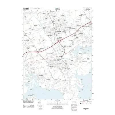
2011 Map of Edgewood
USGS Topo · Published 2011About this map
Edgewood Proving Ground dominates the southern landscape of this coastal Maryland region, where the Gunpowder River and Bush River meet the Chesapeake inlets. This 2011 survey captures a complex suburban and industrial corridor defined by heavy transportation infrastructure, including the I-95 and the historic B And O RR. The transition from old industrial sites like Harford Furnace to modern residential developments like Abingdon and Joppatowne is evident across the terrain.
Find a feature on this map
150 named features on this map. Tap any name to fly to it.
Don’t see what you’re looking for? This feature index may not catch every label — zoom into the map to look around manually.
Map Details
Editions of this 2011 Edgewood Map
This is the sole edition of this map. No revisions or reprints were ever made.
Other maps of this area

1893 · Gunpowder
USGS Topo · 1:62,500

1898 · Tolchester
USGS Topo · 1:125,000

1900 · Havre De Grace
USGS Topo · 1:62,500

1900 · Betterton
USGS Topo · 1:62,500

1901 · Belair
USGS Topo · 1:62,500

1901 · Gunpowder
USGS Topo · 1:62,500

1903 · Tolchester
USGS Topo · 1:125,000

1908 · Tolchester
USGS Topo · 1:125,000

1941 · Gunpowder
USGS Topo · 1:62,500

1942 · Havre De Grace
USGS Topo · 1:62,500
Featured Places
- Edgewood, MD
- Ashby Place, MD
- Harford Furnace, MD
- Reeds at Bay View Mobile Home Park, MD
- Trimble Woods, MD