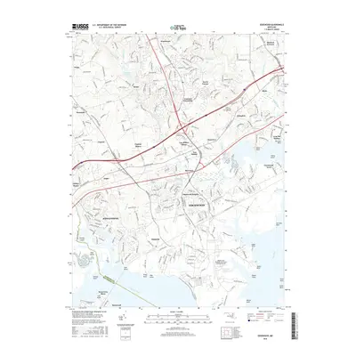
2016 Map of Edgewood
USGS Topo · Published 2016About this map
Edgewood and the surrounding Harford County coastal plain are defined by a complex network of tidal inlets and suburban growth. The landscape is anchored by the Welde Army Heliport on the Aberdeen Proving Ground peninsula, where the Bush River and Gunpowder River converge. The historical development of the region is evident in the contrast between long-established settlements like Harford Furnace and Abingdon, and mid-century planned communities such as Joppatowne. Transportation corridors shape the interior, with the Amtrak line and I-95 cutting through numerous residential enclaves like Clayton Manor and Constant Friendship. Water remains a central feature of the area, from the Atkisson Reservoir in the north to the jagged shorelines of Otter Point Creek and Reardon Inlet, reflecting a coastal geography where land and bay are intricately woven.
Find a feature on this map
77 named features on this map. Tap any name to fly to it.
Don’t see what you’re looking for? This feature index may not catch every label — zoom into the map to look around manually.
Map Details
Editions of this 2016 Edgewood Map
This is the sole edition of this map. No revisions or reprints were ever made.
Other maps of this area

1893 · Gunpowder
USGS Topo · 1:62,500

1898 · Tolchester
USGS Topo · 1:125,000

1900 · Havre De Grace
USGS Topo · 1:62,500

1900 · Betterton
USGS Topo · 1:62,500

1901 · Belair
USGS Topo · 1:62,500

1901 · Gunpowder
USGS Topo · 1:62,500

1903 · Tolchester
USGS Topo · 1:125,000

1908 · Tolchester
USGS Topo · 1:125,000

1941 · Gunpowder
USGS Topo · 1:62,500

1942 · Havre De Grace
USGS Topo · 1:62,500
Featured Places
- Edgewood, MD
- Ashby Place, MD
- Harford Furnace, MD
- Reeds at Bay View Mobile Home Park, MD
- Trimble Woods, MD