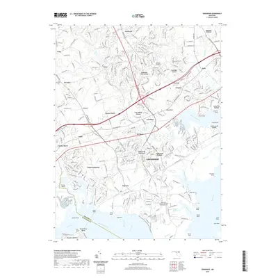
2019 Map of Edgewood
USGS Topo · Published 2019About this map
Edgewood and the surrounding residential developments of Harford County define this landscape along the upper reaches of the Chesapeake Bay. This modern survey illustrates the dense suburbanization that has transformed areas like Joppatowne, Magnolia, and Abingdon while preserving the footprints of older industrial and religious sites. The historical Harford Furnace in the northeast and Saint Francis De Sales Cem provide markers of the region's long human history amid contemporary expansion. The map detail reflects a complex interface of land and water, where the Gunpowder River and Bush River frame numerous points and inlets such as Reardon Inlet and Beach Point. The infrastructure of the Weide Army Heliport signifies the ongoing federal and military presence at Aberdeen Proving Ground, a critical element of the local economy and geography since the early 20th century.
Find a feature on this map
81 named features on this map. Tap any name to fly to it.
Don’t see what you’re looking for? This feature index may not catch every label — zoom into the map to look around manually.
Map Details
Editions of this 2019 Edgewood Map
This is the sole edition of this map. No revisions or reprints were ever made.
Other maps of this area

1893 · Gunpowder
USGS Topo · 1:62,500

1898 · Tolchester
USGS Topo · 1:125,000

1900 · Havre De Grace
USGS Topo · 1:62,500

1900 · Betterton
USGS Topo · 1:62,500

1901 · Belair
USGS Topo · 1:62,500

1901 · Gunpowder
USGS Topo · 1:62,500

1903 · Tolchester
USGS Topo · 1:125,000

1908 · Tolchester
USGS Topo · 1:125,000

1941 · Gunpowder
USGS Topo · 1:62,500

1942 · Havre De Grace
USGS Topo · 1:62,500
Featured Places
- Edgewood, MD
- Ashby Place, MD
- Harford Furnace, MD
- Reeds at Bay View Mobile Home Park, MD
- Trimble Woods, MD