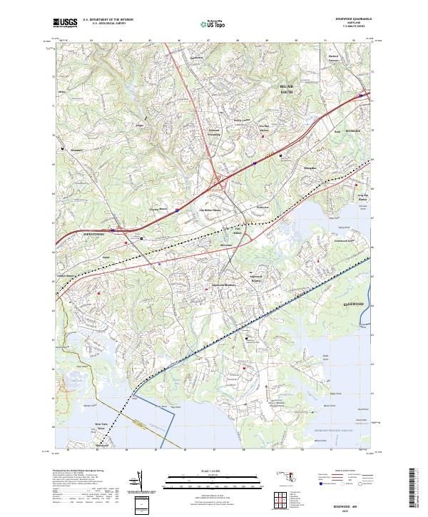
2023 Map of Edgewood
USGS Topo · Published 2023About this map
Edgewood and the surrounding Harford County landscape are defined by the convergence of major infrastructure and the tidal waters of the Bush River and Gunpowder River. This modern survey reveals the dense residential expansion of Bel Air South, Joppatowne, and Abingdon, yet it preserves the footprints of older locales like Harford Furnace and Joppa. A significant portion of the map is occupied by the Aberdeen Proving Ground, where the Weide Army Heliport and the Edgewood Arsenal Post Cem are located. For genealogists and local historians, the sheet identifies key community anchors including Saint Francis De Sales Cem and the Trinity Lutheran Church. The map also illustrates the intricate hydrology of the Chesapeake tributaries, including Winters Run, Otter Point Creek, and Bynum Run, which segment the various peninsulas and planned communities like Constant Friendship and Lou Mar Estates.
Find a feature on this map
74 named features on this map. Tap any name to fly to it.
Don’t see what you’re looking for? This feature index may not catch every label — zoom into the map to look around manually.
Map Details
Editions of this 2023 Edgewood Map
This is the sole edition of this map. No revisions or reprints were ever made.
Other maps of this area

1893 · Gunpowder
USGS Topo · 1:62,500

1898 · Tolchester
USGS Topo · 1:125,000

1900 · Havre De Grace
USGS Topo · 1:62,500

1900 · Betterton
USGS Topo · 1:62,500

1901 · Belair
USGS Topo · 1:62,500

1901 · Gunpowder
USGS Topo · 1:62,500

1903 · Tolchester
USGS Topo · 1:125,000

1908 · Tolchester
USGS Topo · 1:125,000

1941 · Gunpowder
USGS Topo · 1:62,500

1942 · Havre De Grace
USGS Topo · 1:62,500