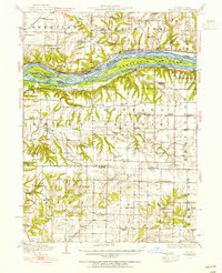
1938 Map of Edgington
USGS Topo · Published 1955About this map
The Mississippi River dominates this landscape, serving as a busy industrial and geographic artery between Illinois and Iowa. Along its banks, the rail networks of the Chicago Milwaukee St Paul and Pacific and the Chicago Rock Island and Pacific follow the river's curve, connecting riverfront towns like Fairport and Andalusia. The river is fragmented by a complex system of sloughs and chutes, including Vealey Chute and the Geneva Island Slough, which isolate large landmasses such as Geneva Island.
Find a feature on this map
78 named features on this map. Tap any name to fly to it.
Don’t see what you’re looking for? This feature index may not catch every label — zoom into the map to look around manually.
Map Details
Editions of this 1938 Edgington Map
This is the sole edition of this map. No revisions or reprints were ever made.
Other maps of this area
1890 · Durant
USGS Topo · 1:62,500
1891 · Davenport
USGS Topo · 1:62,500
1891 · Wilton Junction
USGS Topo · 1:62,500
1894 · Durant
USGS Topo · 1:62,500
1894 · Davenport
USGS Topo · 1:62,500
1901 · Rock Island
USGS Topo · 1:125,000
1901 · Stanwood
USGS Topo · 1:125,000
1910 · Rock Island
USGS Topo · 1:125,000
1912 · Milan
USGS Topo · 1:62,500
1916 · Edgington
USGS Topo · 1:62,500