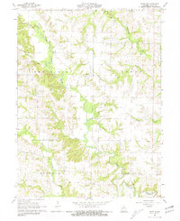
1965 Map of Edina SE
USGS Topo · Published 1981About this map
The South Fabius River and its intricate drainage network, including Troublesome Creek and Cottey Creek, define the rural landscape of southeastern Knox County. In the mid-1960s, this area remained characterized by widely dispersed farmsteads and agricultural operations, linked by a system of light-duty and unimproved roads. Local community life is anchored by landmarks like the Bee Ridge Ch and the Coe Cem, while the industrial presence is marked by a Quarry near the riverbanks. The township names of Bee Ridge, Jeddo, Bourbon, and Fabius reflect the traditional land divisions of the era. This survey is particularly notable for including fine red dashed lines that indicate property boundaries, such as fence and field lines, providing a detailed record of land use and ownership patterns before the modernization of Missouri's rural infrastructure.
Find a feature on this map
15 named features on this map. Tap any name to fly to it.
Don’t see what you’re looking for? This feature index may not catch every label — zoom into the map to look around manually.
Map Details
Editions of this 1965 Edina SE Map
2 editions found
Other maps of this area

1903 · Kahoka
USGS Topo · 1:125,000

1903 · Palmyra
USGS Topo · 1:125,000

1903 · Edina
USGS Topo · 1:125,000

1948 · Quincy
USGS Topo · 1:250,000

1950 · La Belle
USGS Topo · 1:24,000

1951 · La Belle
USGS Topo · 1:24,000
1951 · Deer Ridge
USGS Topo · 1:24,000

1953 · Moberly
USGS Topo · 1:250,000

1954 · Centerville
USGS Topo · 1:250,000

1954 · Moberly
USGS Topo · 1:250,000