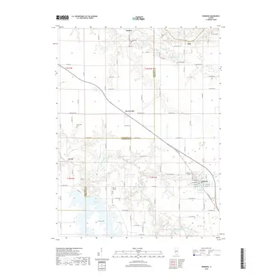
2018 Map of Edinburg
USGS Topo · Published 2018About this map
The South Fork Sangamon River winds through this central Illinois landscape, forming a natural boundary as it meanders toward its confluence with the Sangamon River in the north. The village of Edinburg anchors the southeastern portion of the map, showing a regular street grid including W Douglas St and Washington St. Further west, the northern reaches of Sangchris Lake introduce a significant body of water to the agricultural surroundings, while Tommy's Airpark reflects local aviation history. Scattered small settlements such as Buckhart, Roby, and Breckenridge are linked by a network of rural roads like Boyd Farm Rd and Breckenridge Rd. For genealogists, several burial sites are documented across the countryside, including Finley Cem, Taylor Cem, and Oak Hill Cem, providing important markers of early community life in Christian and Sangamon counties.
Find a feature on this map
91 named features on this map. Tap any name to fly to it.
Don’t see what you’re looking for? This feature index may not catch every label — zoom into the map to look around manually.
Map Details
Editions of this 2018 Edinburg Map
This is the sole edition of this map. No revisions or reprints were ever made.
Other maps of this area

1907 · Springfield
USGS Topo · 1:62,500

1922 · Divernon
USGS Topo · 1:62,500

1923 · Taylorville
USGS Topo · 1:62,500

1924 · Divernon
USGS Topo · 1:62,500

1925 · Taylorville
USGS Topo · 1:62,500

1930 · Springfield
USGS Topo · 1:62,500

1940 · Springfield
USGS Topo · 1:62,500

1950 · Springfield East
USGS Topo · 1:24,000

1954 · Mechanicsburg
USGS Topo · 1:62,500

1958 · Decatur
USGS Topo · 1:250,000