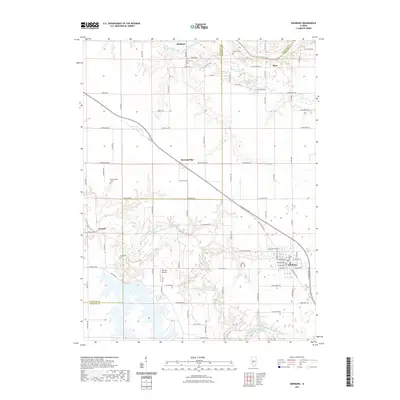
2021 Map of Edinburg
USGS Topo · Published 2021About this map
Edinburg anchors the southeastern corner of this central Illinois landscape, where the grid of rural roads meets the winding path of the South Fork Sangamon River. The terrain is defined by the transition between the flat upland prairies and the carved drainage basins of the Sangamon River and Buckhart Creek. Small settlements like Breckenridge, Roby, and Buckhart are scattered across the northern half of the sheet, connected by a network of established county roads such as Jett Rd and Breckenridge Rd. Genealogists and local historians can find several namesake burial grounds throughout the area, including Taylor Cem and Edinburg Cem. West of Edinburg, Tommy's Airpark reflects the continued use of small-scale aviation facilities within the agricultural landscape of Christian and Sangamon Counties.
Find a feature on this map
83 named features on this map. Tap any name to fly to it.
Don’t see what you’re looking for? This feature index may not catch every label — zoom into the map to look around manually.
Map Details
Editions of this 2021 Edinburg Map
This is the sole edition of this map. No revisions or reprints were ever made.
Other maps of this area

1907 · Springfield
USGS Topo · 1:62,500

1922 · Divernon
USGS Topo · 1:62,500

1923 · Taylorville
USGS Topo · 1:62,500

1924 · Divernon
USGS Topo · 1:62,500

1925 · Taylorville
USGS Topo · 1:62,500

1930 · Springfield
USGS Topo · 1:62,500

1940 · Springfield
USGS Topo · 1:62,500

1950 · Springfield East
USGS Topo · 1:24,000

1954 · Mechanicsburg
USGS Topo · 1:62,500

1958 · Decatur
USGS Topo · 1:250,000