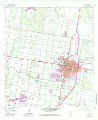
1963 Map of Edinburg
USGS Topo · Published 1984About this map
Edinburg anchors this Rio Grande Valley landscape during a period of significant municipal and educational growth. The campus of Pan American College stands as a central landmark, surrounded by a dense grid of streets like Schunior Street and Harriman Boulevard. The map illustrates the region's sophisticated irrigation network, showing the Main Canal and Santa Cruz Canal cutting through the terrain to support local agriculture.
Find a feature on this map
52 named features on this map. Tap any name to fly to it.
Don’t see what you’re looking for? This feature index may not catch every label — zoom into the map to look around manually.
Map Details
Editions of this 1963 Edinburg Map
3 editions found
Other maps of this area

1914 · San Juan
USGS Topo · 1:48,000

1916 · San Juan
USGS Topo · 1:62,500

1940 · Monte Christo
USGS Topo · 1:62,500

1949 · Mc Allen
USGS Topo · 1:250,000

1954 · McAllen
USGS Topo · 1:250,000

1957 · Mc Allen
USGS Topo · 1:250,000

1962 · McAllen
USGS Topo · 1:250,000

1963 · Monte Christo
USGS Topo · 1:24,000
1963 · Hargill
USGS Topo · 1:24,000

1963 · Edinburg
USGS Topo · 1:24,000
Featured Places
- McAllen, TX
- Edinburg, TX
- Pharr, TX
- Citrus City Lake Number 1 Colonia, TX
- Evangeline Gardens Colonia, Edinburg