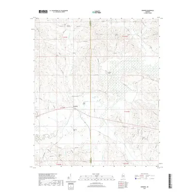
2018 Map of Edinburg
USGS Topo · Published 2018About this map
The Pearl River winds through the heart of this East Central Mississippi landscape, defining the boundary between Leake and Neshoba counties. Near the river crossing, the settlement of Edinburg serves as a local hub, surrounded by a complex network of wetlands and tributaries such as Beasha Creek and Bose Nukse Creek. The terrain is marked by notable high points and flats, including Yellow Bluff and the broad Palmetto Flats to the south.
Find a feature on this map
86 named features on this map. Tap any name to fly to it.
Don’t see what you’re looking for? This feature index may not catch every label — zoom into the map to look around manually.
Map Details
Editions of this 2018 Edinburg Map
This is the sole edition of this map. No revisions or reprints were ever made.
Other maps of this area

1953 · Meridian
USGS Topo · 1:250,000

1957 · Meridian
USGS Topo · 1:250,000

1962 · Edinburg
USGS Topo · 1:62,500

1965 · Meridian
USGS Topo · 1:250,000

1972 · Pearl River
USGS Topo · 1:24,000

1972 · Plattsburg
USGS Topo · 1:24,000

1972 · McAfee
USGS Topo · 1:24,000

1972 · Madden
USGS Topo · 1:24,000
1972 · McDonald
USGS Topo · 1:24,000

1984 · Carthage
USGS Topo · 1:100,000