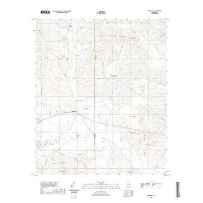
2020 Map of Edinburg
USGS Topo · Published 2020About this map
The Pearl River winds through the heart of this landscape, defining the boundary between Leake and Neshoba counties. The settlement of Edinburg serves as a local hub near the river crossing, while the smaller community of Remus sits to the north. The area's low-lying geography is characterized by features such as Yellow Bluff and the broad Palmetto Flats, which highlight the river's influence on the local topography.
Find a feature on this map
85 named features on this map. Tap any name to fly to it.
Don’t see what you’re looking for? This feature index may not catch every label — zoom into the map to look around manually.
Map Details
Editions of this 2020 Edinburg Map
This is the sole edition of this map. No revisions or reprints were ever made.
Other maps of this area

1953 · Meridian
USGS Topo · 1:250,000

1957 · Meridian
USGS Topo · 1:250,000

1962 · Edinburg
USGS Topo · 1:62,500

1965 · Meridian
USGS Topo · 1:250,000

1972 · Pearl River
USGS Topo · 1:24,000

1972 · Plattsburg
USGS Topo · 1:24,000

1972 · McAfee
USGS Topo · 1:24,000

1972 · Madden
USGS Topo · 1:24,000
1972 · McDonald
USGS Topo · 1:24,000

1984 · Carthage
USGS Topo · 1:100,000